

This way to the Bowcock Roll of Honour >>>
 Posted 20th March 2023.
Introducing Frank’s Monumental Bowcock Marathon
The magnificent monuments of Bowood House and Lacock Abbey are the central attractions of this marathon route that links the three Wiltshire towns of Chippenham, Calne and Melksham, celebrating the outstanding countryside between them.
In between the monuments there’s plenty to enjoy including riverside meadows, flower filled woodland, deer inhabited parkland, and even a smallholding with spitty alpacas and hairy little pigs.
This is a challenge for you to complete on a date of your own choosing. It is free to enter and you can enter as many times as you like in the entry period.
Entries are by Stava file or Garmin. You should set your event Strava event setting to ‘Race’ so that your elapsed time is the one that shows.
Post your achievements, photos and discoveries, and also if any of the route has a blockage or closure. Currently it is all clear.
Your challenge
Your challenge is to complete the 26.2 miles on any day (except Thursdays when a section of the Chippenham to Calne cycle track gets closed) by running or walking the route in a maximum of 15 hours. Ideally you get it done in a single effort, but of course feel free to walk and enjoy the route inbite size sections.
You can complete the route any time from the first day of Spring – 20th March 2023 to the first day of Autumn – 23rd September 2023.
You can take the event on in serious racer mode, or treat it as a beautiful; pub crawl, entirely up to you, there are prizes for both.
With sufficient demand there could also be a 20-mile version. LMK.
The route
There is a GPX of the route available by email. You can request it via frank@frankpublishing.com.
The Monumental Bowcock is a mixed terrain marathon of 26.2 miles. The route is on all surfaces using footpath, permitted private tarmac road, cyclepath and just 2 miles in total of public roads. It’s a Spring and Summer event so there should be very little mud bar occasional gateways, but that is obviously reliant on the weather.
St Andrews Chippenham (front gate) – Monkton Park following the river – Chippenham to Calne cycle track to Calne – Calne Leisure Centre – Bowood estate – Bowood House – Golf Course – Derry Hill (Lansdowne Pub) – Old Derry Hill – Bowden Hill (Rising Sun pub) – Spye Estate – Woodrow (spitty alpacas) – Melksham (The Pig and Whistle is only just off the route here) – Lacock Abbey – Lacock Village (Red Lion pub) – Pewsham – St Andrews Chippenham (front gate)
The elevation profile is flat – hilly – flat. +1491ft/ -1491ft
There wil be a detailed description of the route, including helpful reassurance photos on my website.
Special challenges and Prizes
Proposed date for prizegiving – Thursday 5th October
Participants are encouraged to come to a prizegiving get together on the evening of Thursday 5th October, where we will share tales of our running highlights from the Spring and Summer seasons. My preferred location for this would be The Sports and Social Club Chippenham or the Raj, Chippenham, but I’ll take a look at options and will see which way the wind blows.
There will be Monumental Bowcock momento/ medal of completion for all, and further spot prizes for any outstanding achievements. I’ll be the judge and jury for what equates to ‘outstanding’ but will look out for best runners per club, new or beginner endurance runners, most scenic photographs, best times overall, most pubs visited, wava graded excellence, fastest hill climbers, best flora/fauna pic etc. So, whilst the quickest times will be declared winners this event will celebrate anyone who gets fun out of it or feels accomplished for doing it.
Basically, I’m going to see who gives this a go, and if enough people do, make a fun evening at the end of it, scaled according to take up.
Detailed Route Description
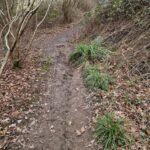
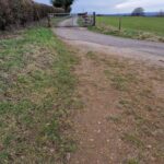
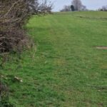
Underneath each block of text is a series of photos that show you that bit! [Currently this description is a work in progress with photos still to be added in the second half of the route]
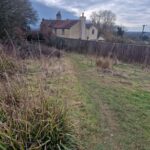
Monkton Park to Calne
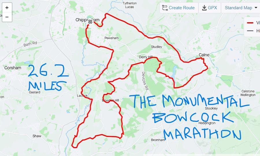
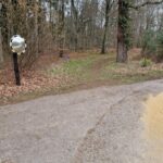
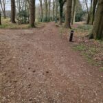
 From the church gate (pic 1) cross the church yard with the church on your left down the steps and cross St Mary St, enter Monkton Park over the river bridge.
Turn right after the bridge signed 403 cycle route.
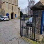
Follow the mix of tarmac and trail along the river bank until you join the end of Riverside Drive and take the zig zag up towards Blackbridge to rejoin the 403 cycle route to Calne, turning right to cross the river. (pic 2)
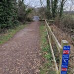
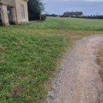
Follow this 403 cycle route to Calne. The 403 briefly joins the tarmac lane (pic 3) before turning back to the trail before Studley Hill. There’s a small car park. The route is clearly marked.
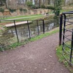
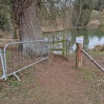
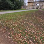
 Arriving at Castlefields Canal and River Park, there are two consecutive bridges over the water, cross the first and turn right before the second (pic 4) wending your way out of the park through the trees and over a narrow bridge. Turn right onto Station Road, before taking the uphill footpath left, just before the fire station (pic 5). The footpath is then straight up the hill, signed to the Leisure Centre to a pedestrian crossing of the A3102. Follow Hazel Grove, Lavender Drive and Maple Close to the Leisure Centre and with the Centre to your left. The trail towards Bowood is ahead-right. (pic 6). This brings you back to the main road. Go straight across it and into the Bowood estate.
Bowood to Derry Hill
 Bowood’s rights of way are clearly marked with blue signs.
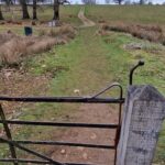
Follow this road straight. There is a fork, take the left option (pic 1), crest the hill and descend. At the time of writing there are closed road signs. These are for cars. The trail is open. The trial turns off right (pic 2) just before the road bridge (and road closure) to follow the waterway then crossing that at the next bridge. Follow the water until turning left (marked as a footpath). There are some nice views of the House and Gardens. It’s a bit up and down and up (pic 3) through here before anincline along a straightish 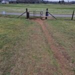
 footpath towards the golf course. Turn right at the gate onto the tarmac (pic 4) just before the golf course. Follow this road. The clearly marked trail turns off left at a bend in the road (pic 5) heading down through trees and then back up to the golf course taking the right fork (pic 6), curving around the golf course the lovely Derry Hill gatehouse (pic 7) before the Landsdowne Arms pub. Go through the gatehouse.
Derry Hill to Bowden Hill
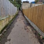
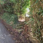
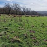
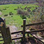
 Cross the busy A342 onto the trail next to the houses (pic 1), then a few jaunty strides and over the stile into the field, heading straight down the hill with a set of wooden steps in the middle. There may be wet holes here as you descend (pic 2). Cross the brook at the bottom via the stile/bridge – expect some mud – then up the other side – Old Derry Hill. My route takes a slight tour of the rewarding hilltop woodland before you come up to the top with views to Chippenham and Lacock. There’s a gateway and tarmac farm road (pic 4) before you’ll hit the top of the lane to descend to Lacock but don’t get too carried away with the downhill as the trail turns left off it (pic 5), initially heading left over the style, back up the hill (pic 6) before finding its way along the ridge and through woodland.
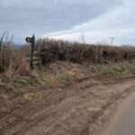
 Then a rewarding descent broken by stiles, before leaving a farm field on the left side curving off before the house (pic 7) and passiong the bottom entrance to the Bowden Estate (pic 8) before the hitting the road near the bottom of Bowden Hill. You are going UP. Pass (or stop at) the Rising Sun which has a fine beer garden. Use the road or verge path up Bowden Hill until the trail is found again on the right via a wonky footpath sign.
Bowden Hill to Melksham
There are steps through the hedge and a path between the house and past their outbuildings.
Once through into the fields cross them looking for stiles. The first stile is found by crossing the field at about 2 o clock (if midday is straight ahead) so arcing right. There are new planted trees in white protectors just the other side of it.
The path is now obvious, a short trot through the trees to the next stile.
After that there are choices ahead. The correct route goes down to the right of the copse. It can be wet here. The GPX avoids the muddy gateway by going over the walker/hunt rail to the right of it before carrying on down the hill on the right edge of the copse.
The next stile is on this line and it has an arrow to indicate, correctly, just left of straight towards the corner of the next field where a double stile with a bridge across the brook awaits.
Once over this, follows ahead with the fence on your right, towards the woodland.
There’s a gate, typically open, into the woods, with style next to it, and an obvious trail past pheasant feeder tubs to the road. Go straight across to the stile which has a warning about shooting season.
Over the stile and follow the straight path ahead keeping the trees on your right.
It brings you to the field corner with a stile and left turn marker on it. Climb over and go left.
Now follow the path straight with the trees on your left.
The next stile is a simple climb over, and straight ahead.
The next stile is almost the same. The path made by walkers follows straight ahead but the actual direction to the stile bridge ahead is about 1 o clock. It is hard to spot from distance but very clear when you get there.
The next bit is a bit more challenging to navigate. After you cross the stile bridge it is tempting to go straight up the hill, but you go across the field at about 2 o clock and won’t see the stile and gateway until you get a bit higher. This stile is down at the moment, and a reroute may be coming. I’m keeping an eye out. For the moment it is a climb over.
Cross the next field heading for the right side end of the woodland with metal 5 bar gate and stile. Climb over and cross the next field on an approximate diagonal, gently downhill to the stile near the corner. Climb over and continue with the hedge on your left at first then switch through the hedge gateway where clearly marked and carry on now with the hedge on your right.
Go through the gateway (often open) or over stile.
Carry on straight for a bit before you enter a field where the hedge goes straight and there’s a yard ahead-right. The footpath is halfway between. You are aiming for the corner stile over a brook. Once over it you can see the next stile slightly left and once over that there’s a clear straight path down the left side of a horse training arena.
It will bring you out over a stile onto a dirt/gravel road with the main house for the small holding ahead-left. The route goes just past that house and the left end of it with the stile soon after on the right.
There follows a few stiles across the small holder land with short gaps between. When I last went through one of the stiles was double fenced with white tape which I had to duck through. Be reassured here, the owner was perfectly friendly when I met him, and the temporary fencing was intended to keep a pony in and not walkers or runners out.
The hairy pigs currently live on this part of the rout with a low fence between them and the footpath.
There are footpath markers right through this agility test smallholder bit.
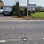
After that you may be pleased to hit the road and you do, taking Woodrow Road to Melksham ‘Forest’.
The tun off Woodrow Road is kindly marked by an unmissable red pillar box by a white house, but if you do miss it, you get a bonus pub, The Pig and Whistle.
Melksham to Lacock
Pass the pillar box. At Bowden Cres turn left. At T Junction Littlejohn Ave, turn right, at Methuen Avenue turn left. The trail is soon after on the right.
Enter the farmland through/beside the metal gate with the pylon ahead. There another similar gate straight ahead, go through/beside that one. The next gate (a pair of gates) is slightly to the right of straight, on the right side of a tallish tree.
In the next field head straight, which is slightly to the left of the pylon then on to a metal gate, before a farm access road, cross that and enter the field opposite via the end to end 5 bar gates. Straight across the next field to another metal duo of gates.
The next field is crossed just to the right of the telegraph pole in distant view with another metal gate between the trees towards the field corner.
The next field is crossed similarly, with another metal gate to aim for.
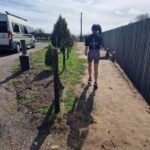
The next crossing to aim for is a hard one to find as it is a camouflaged wooden stile bridge quite far left of the farmhouse and dairy yard. Liliana is in the picture to help show the direction.
Head just right of straight across the next field and you’ll see another stile-bridge combo that is no longer used because the way is open next to it on the right side.
Near enough straight across the next field to another metal gate.
Keep on in the same direction through another three gateways, bringing you closer to the river.
You should be able to spot the road and road bridge into Lacock ahead. The exit is a stile by the bridge. Go over it and left on the road to cross the river. Follow the road into Lacock, past the National Trust visitor entry and on to the Red Lion pub. Pass that and turn right in the village towards the bakery and right again at the end of the road towards the church. Then left just before the church and past the ford (either go through the water or use the walkway) carrying on up the hill.
Lacock to Finish
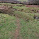
At the top enter the field via the footpath wooden gate. The field crossing is tarmac to the exit. Once exited come down past the houses, bear right then cross the road bridge right taking the footpath gate on the left soon after. Cross the field on the diagonal trail then straight across the access road into the fenced footpath through the trees. Over the double stile and left to go around the border of the field until the double stile on the left, then follow the trail up the slope and over the corner stile, then a short distance to the next stile. Go over that and you are on the canal footpath. The canal becomes more and more canal-like as you follow it. Keep going straight for a couple of miles, staying with the canal until the path begins to climb next to a lot of metal fences/restoration works area. The path towards Pewsham follows soon on the left accessed via a wooden gate.
The path here is fenced either side so follow it through 3 gateways until you get to the bit where it runs parallel to the main road. At the lane turn right up the small hill before finding the trail again soon on the right. Go through the gate.
At the next road junction go right (not straight across) then back onto the trail via the cattle grid + gate.
Stay on this path now to Chippenham. When the Arc (tall building for indoor climbing wall) is ahead to the right of the path you are on head across the grass to the right end of it. Passing that there is a scout hut to also pass on the right end. Leave the grass, cross the car park. Head up the hill via the footpath to Wood Lane. Cross Wood Lane left to right then the same at The Causeway to finish at the church gate.
Well done. Meet any friends who were ahead or behind you at the Flying Monk!